The Restricted Cliffs of Hanover Bluff

The Cliffs of Hanover Bluff

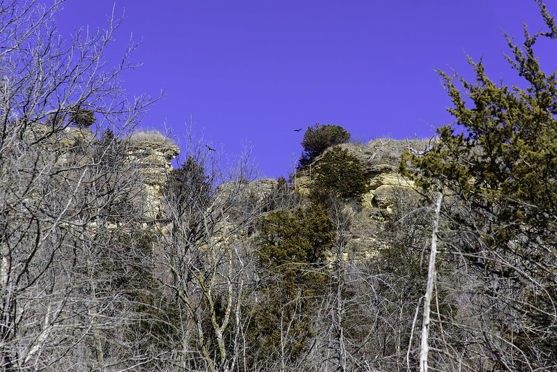
The tall stone cliffs of Hanover Bluff Nature Preserve seen from afar. The area is now restricted, and not open to the public. We wandered around the area for quite some time, looking for an open trail, but were not successful. A DNR officer happened to drive by so we flagged her down and asked about access, and were told the area is no longer open to the public because of fragile and endangered species in the area.

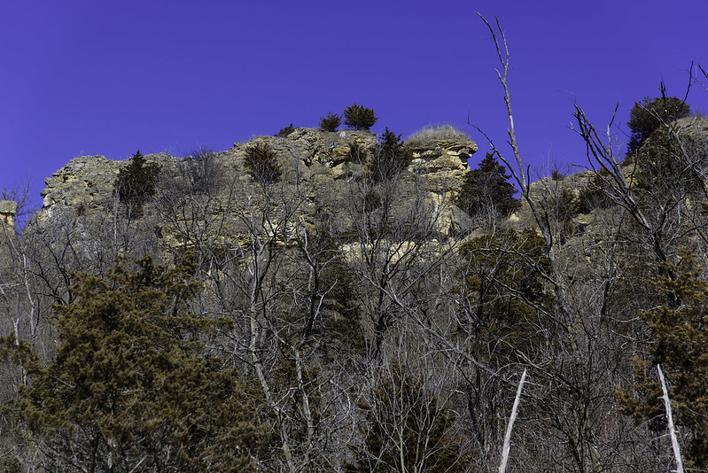
We continued our walk down the dirt road with hopes of seeing some cliffs, and we did find a few.  It seems the outer cliffs were the only ones that could be seen from the public road. Beyond these cliffs, another row of cliffs exists with a flat, low area between them. There was at one time some sort of mining operation in this area, and that may have created the dual bluffs seen today.

As we walked along, we noticed plenty of large birds flying around the bluffs, without worry about any human bothering them.

 The Outer Cliffs of Hanover Bluff

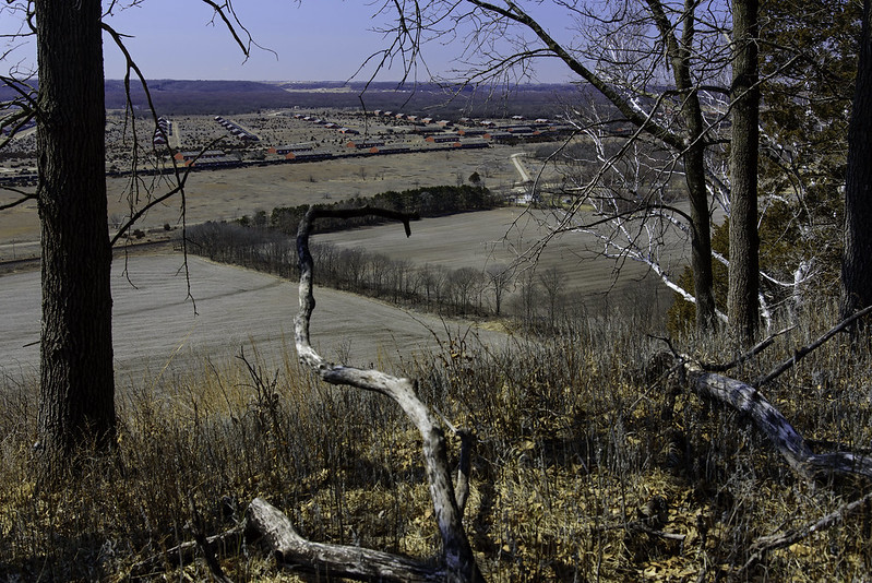
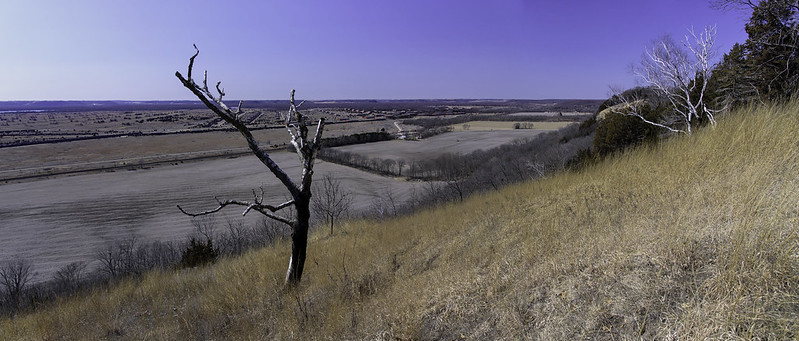
It was pretty disappointing not to be able to explore the area between the bluffs, but at least we did get to wander through the areas that were not restricted, and take in the views of the area below.

Perhaps one day the area will open again to the public.

The View From Hanover Bluff

The SVAD From Hanover Bluff

After a long hard climb to the top of the bluff, we were rewarded with a fantastic view of the valley below. No trails led to this open area on top of the wooded bluff, well over 100 feet above the flat Mississippi River valley, but we managed to navigate our way up and find the only clearing on the bluff,

This portion of Hanover Bluff is part of a large wooded series of rolling hills and stone cliffs. Most of this area is restricted, so the public is not allowed to enter. The areas we were initially looking for were clearly marked "Restricted" so we continued until we found an area that was not closed to hiking. While we weren't able to explore the rocky cliffs we came so far to find, we did manage to find an elusive clearing with a great view.

High Above the Mississippi Valley

Below us was the old Savanna Army Depot (SVAD), a sprawling military installation used between 1917 and 2000. Zooming into the images here, you can clearly see dozens of buildings in this installation. Even farther away are farms across the Mississippi River in Iowa.

This area was very difficult for us to reach, the hills were very steep, and at times, we slid down uncontrollably, only to have to climb back up. Ever careful of stepping on plants or small creatures, we slowly made our way up until we reached the clearing.

With every intention of climbing the rolling, wooded hills all the way to the rock cliffs, we headed toward their general direction with no trail or markers to follow. A short distance later, we encountered another "Restricted" sign; this ended our exploration for that particular hike. A future hike in the area is planned, and with any luck, we'll received authorization to explore the restricted areas including the rocky cliffs of Hanover Bluff.