One of the Sister Waterfalls

Canyon Icefalls

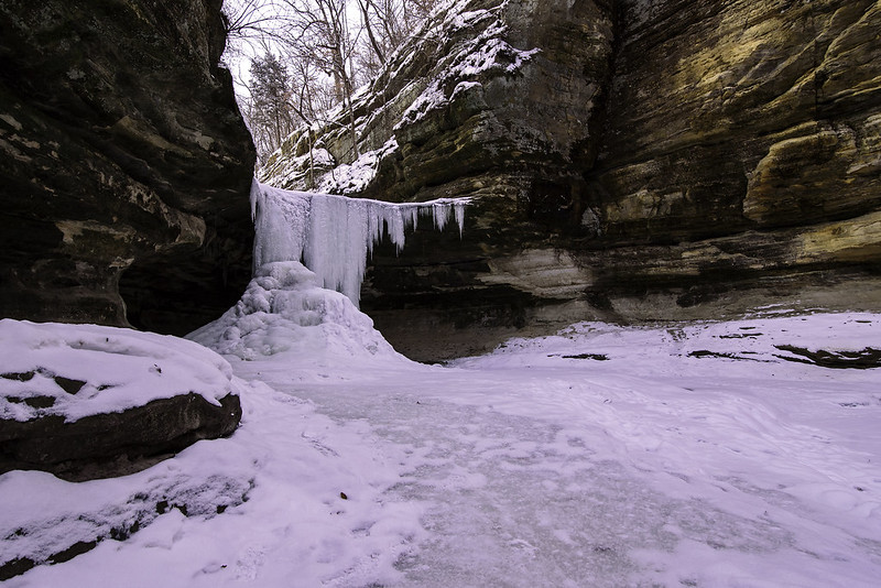
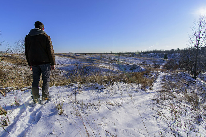
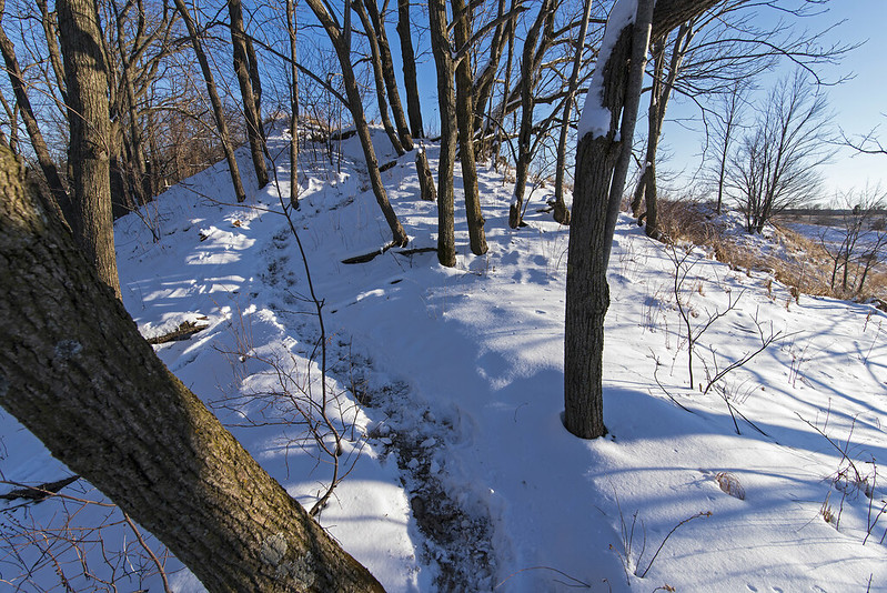
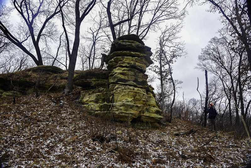
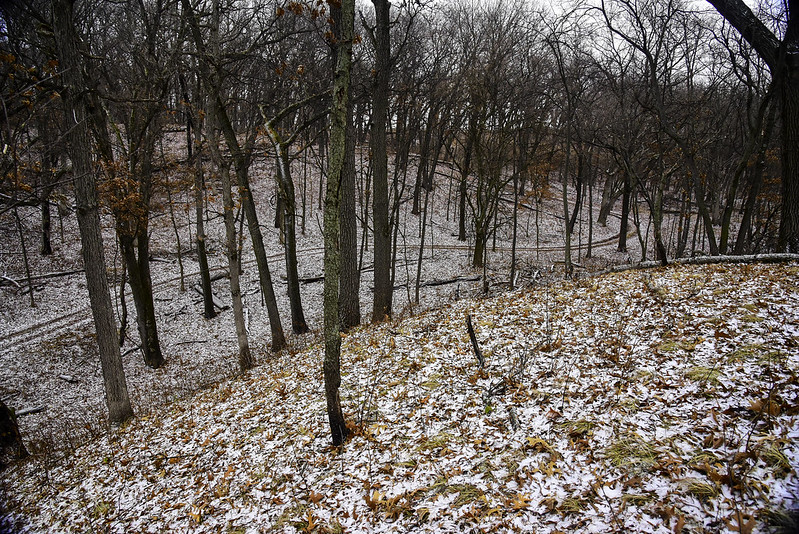
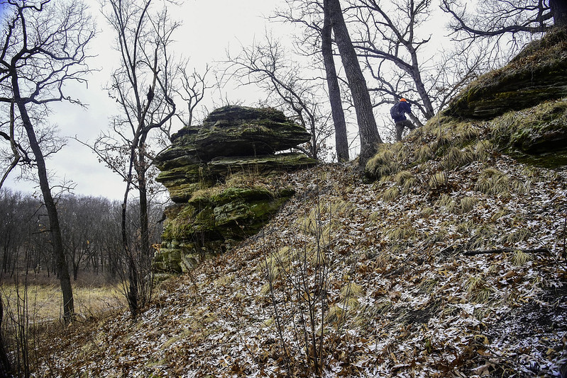
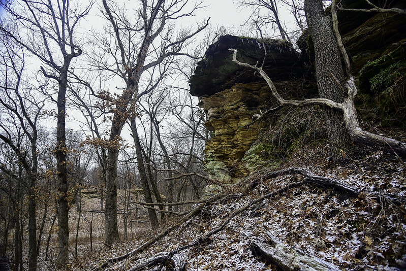
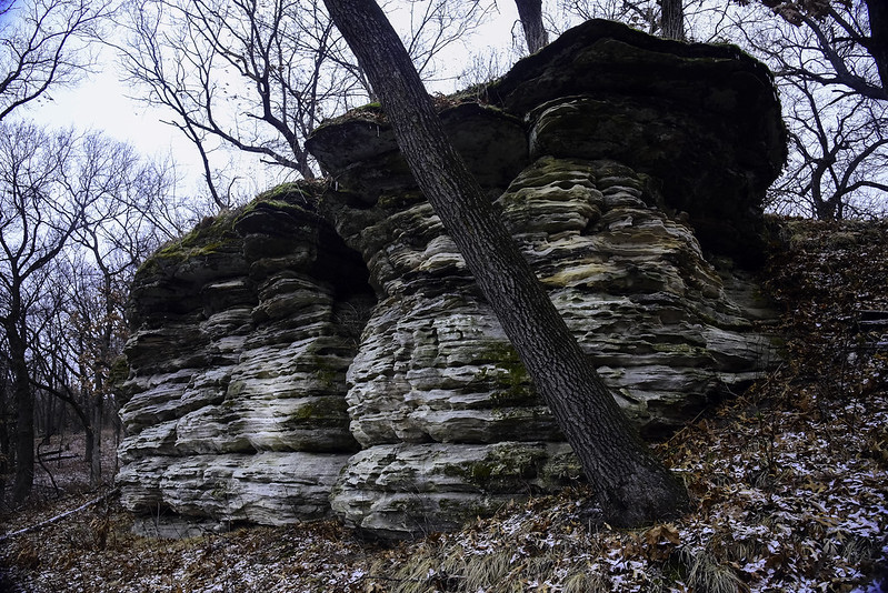
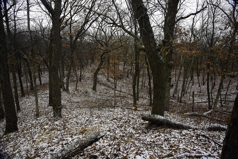
While hiking the upper dells of Matthiessen State Park, an area called Cedar Point marks a sharp turn in the canyon floor. Hidden from view are two waterfalls relatively close to each other, that many people overlook. If you're willing to cross the creek, you will easily discover these waterfalls, but so many hikers don't bother.

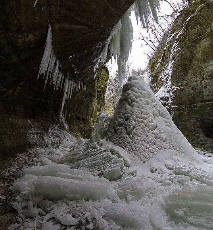
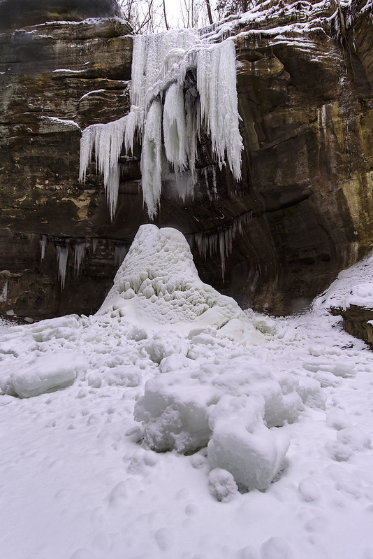
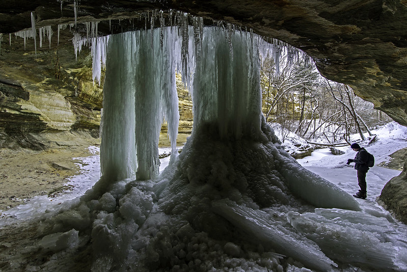
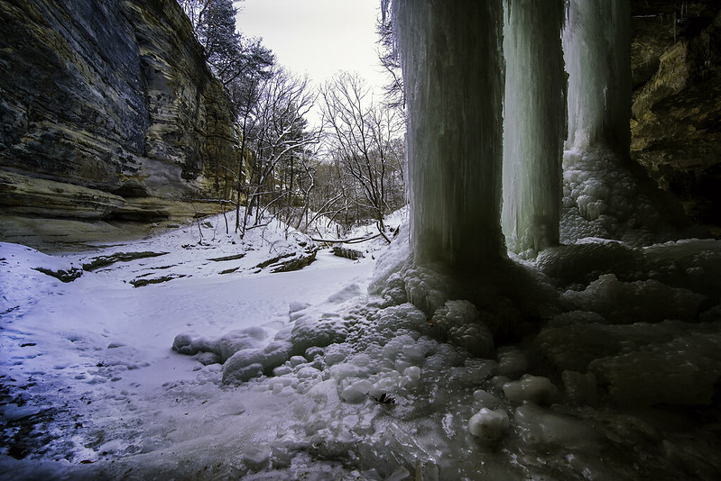
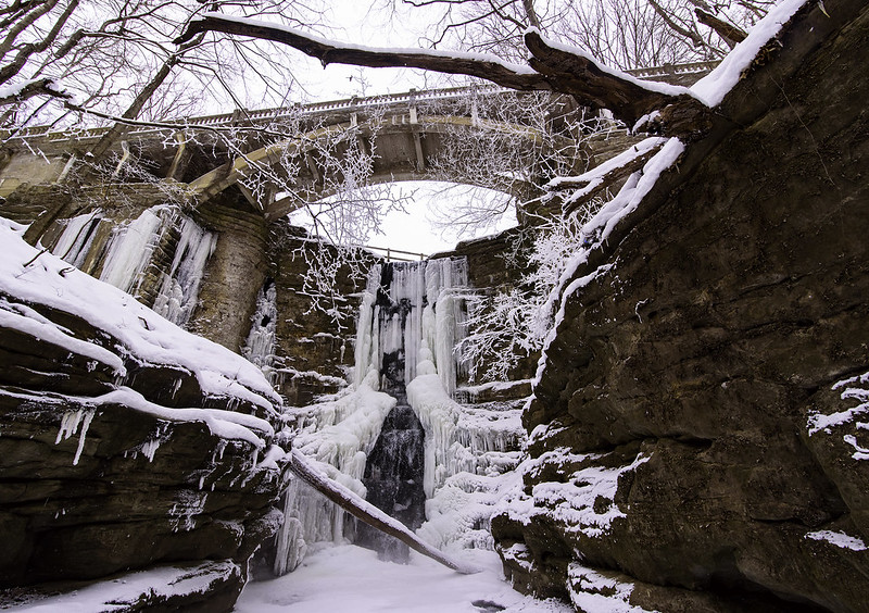
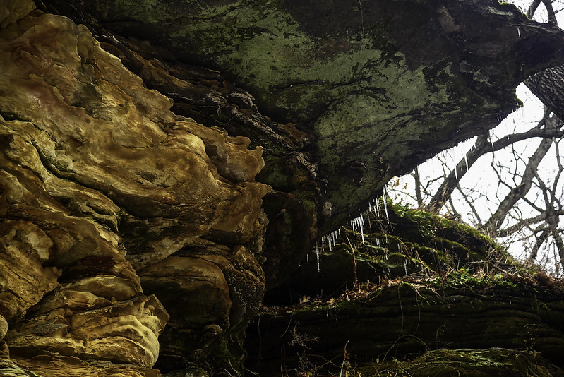
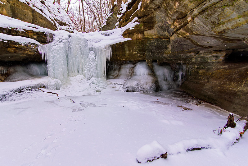
In winter, these slow waterfalls create ice falls that are always impressive. The ice is generally such that the backside of both waterfalls is accessible, creating ice caves between the ice and the stone overhang.

Exploring the Ice Cave

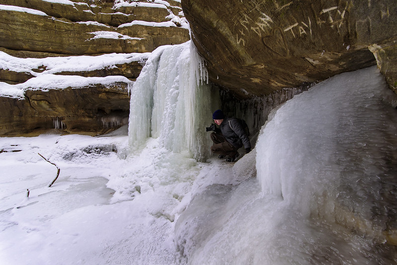
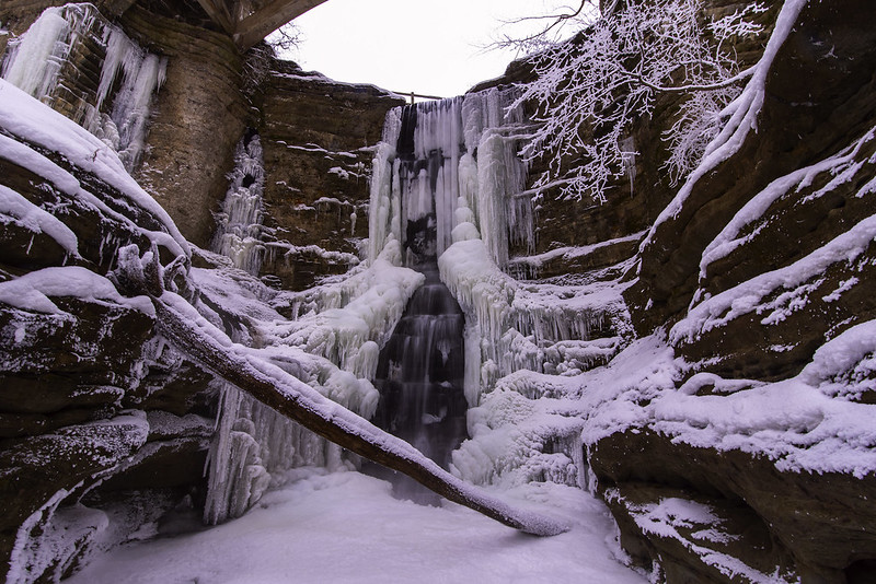
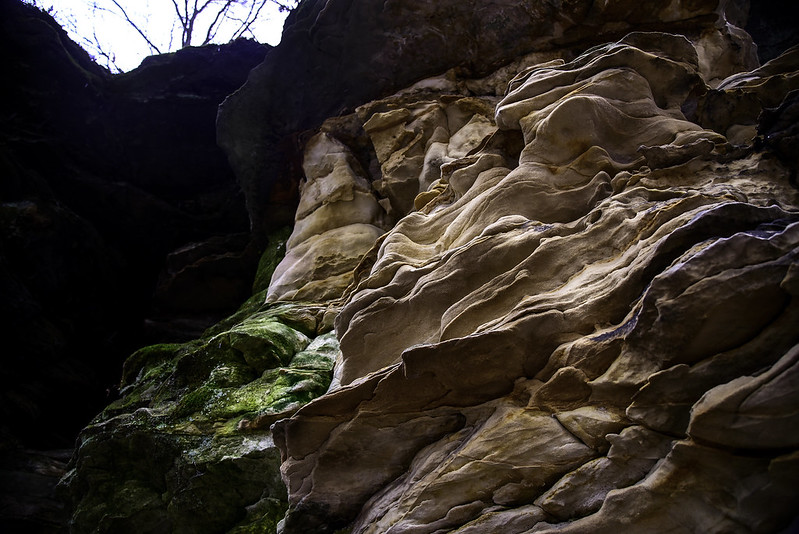
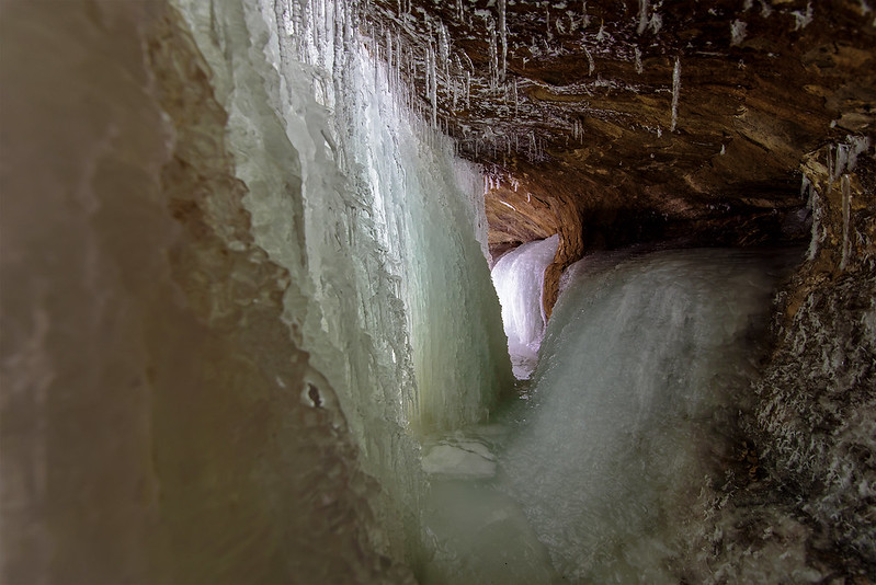
With a bit of climbing on the slippery canyon floor, you can get into the ice cave and see an unusual environment. The soft light illuminates the interior of the cave, and also shines through the translucent ice.

Once inside you can see exactly how the water flows over the canyon walls. Frozen, the water seems as though it flows with a turbulence at high speed, but in fact, in merely trickles down and builds up over time.

Turbulent Interior

If you feel like exploring these ice falls, remember to dress warm, wear ice cleats to prevent falling, and prepare to get wet. These ice falls are still flowing with water - sometimes on the inside of the ice, sometimes over the outside, but either way, you'll get wet or soaked. The floor of the ice cave is usually soft ice with water three or four inches deep.

If you get wet, you have a long, cold walk to the parking lot.

Tonty Canyon's Icefall Progress

Tonti Canyon Icefall

A close neighbor to LaSalle Canyon is Tonty Canyon, only about a quarter mile or so away. Tonty boasts two waterfalls, and in winter, two icefalls.  The main icefall is coming along nicely, but not as large as some of the other canyons at the park.  The water is flowing quite a bit, so with the forecast of bitter cold weather, there's little doubt these falls will be much larger in the next few days.

In a few weeks time, these falls should be large and strong enough to climb. I've noticed that Tonty Canyon's icefall is one of the more delicate looking, with a lot of intricate details. This must be due to the rock's shape overhead, forcing the water to follow a meandering path down to the ground.

Tonti Canyon Waterfall

You can see the ice columns forming at the top of the falls, in the shape of tubes. The water will continue to flow through the inside of the ice columns all winter long. I'd estimate this fall to be 40 to 50 feet in height.

The LaSalle Canyon Icefalls

Behind LaSalle Falls

One of the most popular places to visit in Illinois is Starved Rock State Park. While most people visit in the warmer weather, or make a quick visit in February to view the large number of eagles on the Illinois River, I enjoy the cold winter months. Most of the canyons of Starved Rock have waterfalls at some point in the year, and most create stunning icefalls in the cold months.

The waterfalls range from ten feet tall to well over 70 feet tall, and some can even be climbed with the proper gear and permission. A small number of these frozen waterfalls allow for viewing on all sides, and the waterfall in LaSalle Canyon is one of the easiest to access.

Ice Columns

While not the closest canyon to a parking area - it's a mile hike or more to the waterfall, the trail leads behind the waterfall, giving you a unique perspective of the frozen falls in relation to the canyon. The sun shines through the large towers of ice, illuminating the backside with beautifully eerie light.

The size of the rock overhang also makes it very easy to walk behind. Some other waterfalls are so close to the canyon wall you must crawl behind. The only tricky part can be the ice on the canyon floor. In some places the slanted rock is glazed with thick ice from the waterfall, so ice cleats are a necessity. Last year as I hiked behind a couple of people, one slipped and fell down the side of the path. She held onto a small tree trunk, which prevented her from falling down the 30 foot drop to the canyon floor. Her hiking partner and I quickly pulled her back to safety. I won't hike this area without ice cleats - not the little yak tracks with the springs or studs on the bottom, only chain and spike ice cleats that dig into the ice.

LaSalle Canyon in Winter

This canyon has two waterfalls, the main waterfall seen here, and a much smaller one draining into the creek which drains into the Illinois River a few thousand feet away. LaSalle Canyon is a must see in the winter. It also serves as the path the Tonti Canyon, which often has two tall waterfalls in the cold winter months.

Frosty Lake Falls

Frosty Lake Falls

Recent temperatures below zero have begun to freeze the waterfalls in northern Illinois. Lake Falls, the tallest waterfall in Matthiessen State Park was impressive this afternoon. The mist created by the falling water froze to almost every surface nearby, including the bare tree branches which became flocked with ice.

Any of the mist that landed on the camera lens froze almost immediately, making photographing the falls any closer next to impossible.

Freezing Lake Falls

A bit of knowledge of the canyon floor comes in handy in winter. Knowing where the deeper places are in the creek helps keep your feet dry. Stepping on thin ice could result in falling through, but if you know where the shallow areas are, breaking through will only get your feet wet. Good to know when you have quite a long walk back in zero degree weather.

The 45 foot tall Lake Falls is at the head of the upper dell area of Matthiessen State Park, draining from above, and created by the man-made dam built to create the lake.

The Open Dunes

Trail to the Lonely Tree

Rounding the turn from the last trail, we came upon the ridge of a tall dune. The view at this point is wide and deep, the dunes roll out in front of you to the horizon. It's this place we first spotted a tree we call the lonely tree; this tree is virtually in the middle of nowhere, and many years ago, we were determined to find a way to this tree. This is how we found this series of trails to explore.

From wooded dune to grassy, open fields, the trails here wind in and out of numerous features, each with their own beauty. From these vantage points, we can see multiple features at once.

Distant Dunes

Again the trail turns from open to wooded. These trees seem to mark the entrance to the next part of the environment.

Blanketed Dune

We always need to remember to turn around and look at what we passed, and in this case we glanced back toward Lake Michigan, where the snow blanketed the dunes and provided a strong contrast to the dormant vegetation.

The Little Dune and Beyond

Little Dune

On our frequent hikes through the Indiana Dunes, we encounter landmarks along the way, and it's interesting to see these landmarks change with the seasons and over the years. One of the landmarks is located at the bend of the trail, close to Lake Michigan. It's a small living dune, only about 25 feet tall, but it stands out against all the other larger, grassy dunes around it.

As tempting as it has been to climb, a living dune that small would most certainly be ruined by people walking on it, so we keep off of it. Here, the bare sand is covered with fresh snow, hiding the fact that it's a living dune. A living dune is one that is still being moved by the winds. The sand is pushed from one side to the other, so in effect it moves slowly inland.

Up Through The Woods

Turning away from the little dune, we headed on the next part of our hike, the adjacent trail leading to another of our landmarks, the lonely tree.

Once again, the trail headed up the rolling dunes through some woods where the trees provide a shady resting place for hikers.  In fact, these trees are low enough to sit in and enjoy the view of the dune valley.

Lunar Eclipse of 2019

Lunar Eclipse 2019

The full moon of January 2019 came along with several names:  Super Moon, Wolf Moon, Snow Moon, Blood Moon, Super Wolf Blood Moon.  Super Moon because the moon was a bit closer to earth than usual, making the moon appear a little larger and brighter than usual. Wolf Moon because of the packs of wolves that once howled near Native American villages in midwinter (or Snow Moon). Blood Moon because of the red color the eclipsed moon takes on.

Of course the weather rarely cooperates with photographers, and this night was no exception. Clouds moved in and out of the area, and the temperatures was 6 degrees F. The cold weather usually helps with sky photography because there is little haze in cold weather, but this time it only served to make detailed work painful.

Blood Moon

The eclipse began just after 8:30pm, but it was not really visible until 9:40.  The moon gradually disappeared by 11:20 where it then became fully eclipsed and took on the famous red color of the Blood Moon. 

Photographing the moon is usually very easy - it's very bright actually. The eclipsed moon is dim, and with such a long lens arrangement, my aperture would only go to F13 - very small, and will not let a lot of light into the camera. So, challenges had to be overcome.

The best part of the dimly lit moon is the fact that you can actually capture the stars in the sky along with the moon.

 Blood Moon With Stars

A View of the Dune Valley

Dune Valley One generally doesn't associate the Indiana Dunes National Lakeshore with wide open spaces, but that's just what you'll find when you hike a bit off the popular and well traveled trails. Beginning from the beach, we hiked up through some wooded dunes, along the ridges to an area filled with Marram grass. A quick run up the grassy dune and we encountered the vast valley behind the fore dunes hidden from the beaches. This is where you begin to get an idea of the size of this natural area along the shore of Lake Michigan. From the trail head to this point in our hike, we walked a bit over a mile and spent around 40 minutes of time exploring the area. Shorter hikes are possible on these winding trails, but we were up for a much longer one on this sunny winter day. Running Up That Hill We've hiked these dunes in all seasons and in all weather, and there's always something new to experience each time we visit. Remembering to stop for a bit to take in the surroundings is an important part of these hikes. It's easy to get caught up in photography, or the need to get to a particular place in the park, but you need to stop at multiple places along the trail and just look, listen, and smell - take it all in. It's surprising what you'll experience.

Blue Shadows

Blue Shadows

Once off the beach, we enter the wooded portion of the dunes, where the back-lit trees cast blue shadows in the fresh snow. In winter, we can see Lake Michigan on the majority of the wooded portion of the trail, a few hundred meters to our right, but in the summer, it's mostly hidden by the dense woods.

Portions of the trail are rugged, and a bit strenuous if you're not used to hiking on soft, steep terrain, but it's not a straight climb up, it's rolling up and down throughout the entire trail. That's one of the great things about hiking through most of the dunes along Lake Michigan, you get a break on your way down each time you traverse a dune.

The Trail Up to The Ridge

A great view appears at almost every turn on these trails, and you have to remember to look back every so often, because you don't want to miss the view from that angle. Almost to the first dune ridge, the woods begin to thin, and the grassy, open dunes appear in the background.

At this point, the sound of the waves begin to disappear, and the winds are blocked by the fore dunes, giving us a bit of warmth compared to the open beach below.

Fresh Snow at the Dunes

Looking Back From the Trail Head

Following a busy day, we headed out for a late afternoon hike at the Indiana Dunes National Lakeshore. Yesterday's snowfall made it all the more fun - especially with the bright sunshine. We haven't been here since the holidays began, so it was great to be back.

We decided to hike two trails that connect, our standard dune ridge trail, then what we call the lonely tree trail. These trails are pretty strenuous at times, but like most trails through sand dunes, it's up and down, up and down, not a severe climb up most of the way.

Cold Walk on the Beach

As usual, our hike began on the beach. For mid January, it was unusual not to see any ice on or near Lake Michigan, but it's been rather warm lately. the only ice we found was stuck to driftwood washed ashore by recent waves.

The Winter Beach

As we approached the trail, we headed inland, and just before we entered the wooded dunes, we turned back to look at the snow covered Marram grass and Lake Michigan. The low sun washed over the snow, highlighting all the contours of the dune.

This was just the beginning of our quick, two and a half hour hike through the rolling dunes.

The High Point of Grand Mere

The Tallest Dune in the Park

Following an afternoon of hiking the beach, dunes, and woods of Van Buren State Park, we took advantage of the daily pass and used it at a smaller, less visited state park a few miles south. Grand Mere is a bit out of the way, and much less traveled, but worth the stop.

The small parking area holds a few cars, and it's a good hike to the dunes and the shore of Lake Michigan. In addition to the rolling dunes, dense woods, and the beach, this park has two or three small lakes visible from the top of the taller dunes.

Steep Climb Up
Of course we had to explore the tallest dune we could fine. Getting there required us to hike through the rolling dunes, then to the beach and finally over to a narrow trail through the wooded dunes. We followed the trail through the trees until we found the small trail up to the top. While it might not look like a tough hike, these last few meters were the most difficult, and really tested out our legs. Well, we did spend the day hiking hilly terrain, so that made this all the more challenging.

Once to the top, we were immediately greeted by the view -a sweeping vista of the countryside, wetlands, and lake below. With the day ending, we headed down another trail on the opposite side that brought us toward the lake, onto another trail that meandered to the parking area.

Looking Back at the Way Down

Looking back at the trail down the dune, we were certainly happy we didn't need to climb back up to get home.

Lost Horizon

Lost Horizon

While hiking the rugged dune ridges parallel to Lake Michigan, the horizon seemed to disappear, was lost in the overcast sky. At times, it completely disappeared, which make our hike a surreal experience - imagine hiking along a wooded ridge with a vast open area next to you with no bottom and no top - that's how it appeared at times.

The winter season makes it easier to see distant objects and formations while atop the dune ridge; the lack of leaves makes this possible. We looked back at the trail winding from dune to dune and the woods and blowouts in the distance, and noticed a pair of A10 Warthogs flying just above the beach. They flew north then about 30 minutes later, we saw them again. This time, we were at the top of a blowout, an open area on the dune. We waived and were surprised the pilot of the second craft tipped his wing toward us as an acknowledgment. Too bad I didn't have my telephoto lens on my camera body, I could have had a few photos of the crew.

A Hike on the Ridge


Nachusa Buttes

Stone Barn Butte

Rounding the corner of the trail next to this sandstone butte, more of the bluff can be seen, and the ever eroding stone stands out prominently against the brown grass of the savanna. While hiking in the summer, we saw these rock formations through the trees, but they were often obstructed by the leaves. This seems to be one of the best times to view the rock formations, we saw some bluffs we never noticed in the summer.

Stone Overhang

Walking closer to the stone bluff, we took time to look over all the details of the rocks and what the weather created out of them as they eroded. Looking from underneath, what little snow that fell onto the stone over the past day or two began to melt, but froze again once it hit the cold air. Small icicles trimmed the edge of the bluffs, reminding us it was the winter season.

From the Butte

Once we found a safe way to the top of the bluff (walking up the grassy hill behind), we were able to look over the landscape and view the woods we walked through on our way through the Stone Barn Savanna.

Stone Barn Savanna Buttes

Sandstone Remnant

One of the most interesting features of the Stone Barn Savanna are the sandstone buttes and cliffs that seem to rise out of nowhere. These are a typical geologic feature of this region of Illinois, yet there are only a handful of nature parks where these can be seen.  Fewer still, are places you can get up close to them to inspect and study them. Nachusa Grassland allows visitors to explore off the trails providing they don't climb the rocks.

This formation is one of the few freestanding buttes in the area, and it's easy enough to investigate up close. The layers and colors in the rock are quite captivating, and change with every turn of the head. This butte is on the edge of a flat clearing, making it a dividing feature between the hilly and flat areas of the park.

Sandstone Detail

Additional sandstone cliffs dot the Stone Barn Savanna, some tall, some relatively short and crumbling, but all interesting to explore. We were able to walk up the grassy hills on the backsides of some, following animal trails through the prickly prairie roses. Careful to stay off of the rock, we were able to view vast areas of the woods and nearby grasslands.

Disintegrating Bluff

Exploring the Bluffs of the Stone Barn Savanna

Sandstone Bluffs

Part of the 3,600 acre Nachusa Grasslands, a large, successful restored prairie project in north central Illinois, the Stone Barn Savanna offers a hike through wooded bluffs and rolling hills. Sandstone bluffs appear suddenly from the landscape, some free standing, others are one end of large, grass and wooded hills.

Visitors to Nachusa are encouraged to explore the land. Mowed grass trails can easily be followed, but hiking off trail is allowed as well, providing you don't climb the fragile sandstone, these can break easily causing damage to the formation as well as injury or death to the climber.

We followed the trails to places of interest, then carefully explored these areas off trail. This was not always easy as the landscape is rolling, and filled with prairie roses  and other barbed plants. Don't wear shorts here!

Exploring the Sandstone Cliffs

Sometimes these bluffs aren't easily noticeable because they are covered in soil, grass, and trees. This allowed us to safely explore the tops of some bluffs, and walk the ridges.

Some evidence of wildlife was found on the tops of the bluffs, including well worn animal trails, and animal scat near small crevasses in the rock. At one point we discovered a trail camera pointed at a particular opening in the rock; I'm curious as to what they find.

 Ridge of the Bluff

It's refreshing to find a nature preserve that allows visitors to explore everywhere on their own. The access areas and parking areas are small, so not too many visitors can hike at once, but this is probably a good thing - it keeps the area pristine, quiet, and free of crowds.