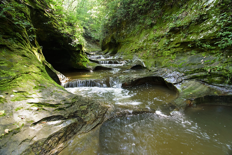
When one thinks of potholes, damaged city streets come to mind, but the potholes of Fall Creek Gorge are far from any urban area, and actually a welcome sight. Found along the narrow canyon formed by Fall Creek, these round holes in the creek bed were formed long ago as water pushed rocks around small depressions in the rock. Over time, the eroding action of the water and stones created these potholes. Each pothole is around 4 feet in diameter, and around 3 feet deep, making a series of small pools perfect for relaxing in - just like a personal spa. And on previous visits, I've encountered people lounging in them.
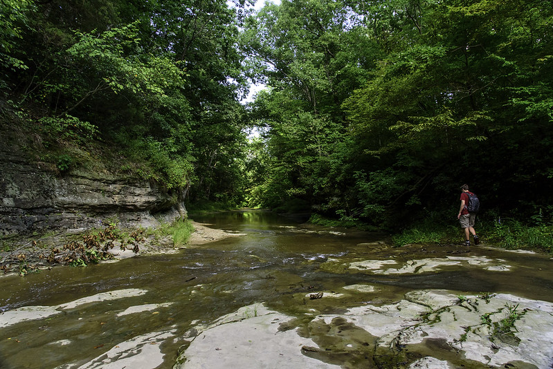
The most interesting potholes are along the narrow gorge, where the elevation changes, creating a series of interesting waterfalls. But the formations are more easily seen along the level stretch of creek just downstream of the falls. It's a good thing the water is clear, walking through this area could result in stepping into one of the potholes, a change in water depth from 3 inches to 3 feet or more.
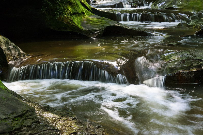
The small waterfalls provide seemingly endless photographic opportunities, but I found myself, as usual, stepping back to take in the surroundings for a while. There aren't too many environments like this in the Midwest, or anywhere for that matter.
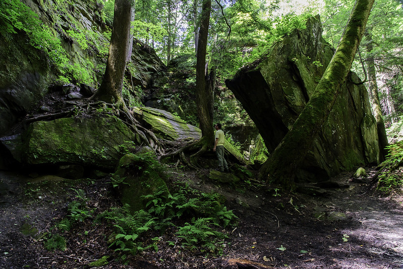
Fall Creek Gorge is a bit out of the way, and certainly off the grid. There are no signs guiding you to this preserve, and the only access is a small parking area, suitable for three or four cars. Once the parking area is full, visitors are asked to come again some other time, as too many people can damage the area. Volunteers keep the gorge clean, and also make sure visitors are obeying the rules outlined on a small sign at the trail head.
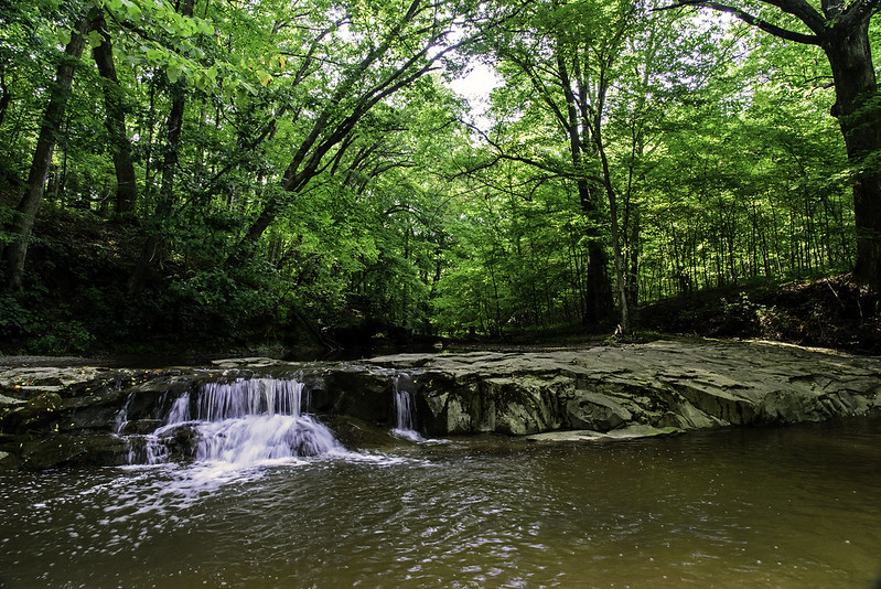 Visiting the potholes of Fall Creek Gorge, we explored a bit more of the preserve, following a narrow trail upstream until we heard the sound of falling water. We came upon a waterfall that seemed to be carved into a perfect stone wall - almost as if it was man-made. The rock here, changes level abruptly, and evenly, giving this natural waterfall the look of a stone dam.
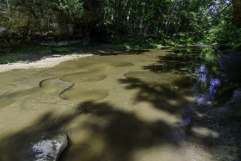
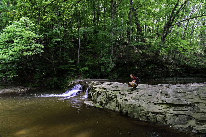 Stopping on the "dam" of rock following a bit of exploration, gave us the perfect view downstream toward the popular potholes of the gorge, and a bit of time to take in our surroundings. This very small preserve isn't too well known, so running into other visitors is unlikely - we had the place to ourselves, and enjoyed hearing only the sounds of nature.
 The potholes were only about 100 meters downstream, but with our camera gear, it's all but impossible to walk back through them, plus, it's not allowed. But we did explore a bit more of the creek.